“ The Leader in Engineering Service Consultants ”
02 270 8899
HOME
ABOUT US
ABOUT US
History
Vision & Mission
Board of Directors
Business Group
Organization Chart
Quality standards
SERVICES
SERVICES
Geotechnical Services
Quality Assurance
Pile Testing
Geotechnical Instrumentation
Structural Testing and Assessment
Infrastructure Testing
Civil Work Monitoring
Survey and GIS
Engineering Design
Environmental Project
Laboratory Services
Environmental Monitoring & Marine Survey
Construction Management
PROJECTS
NEWS
JOB
ALL ABOUT TESTING
Good corporate governance
Good corporate governance
Charter
Policies and important documents
Complaint reporting
CONTACT US
x
HOME
ABOUT US
ABOUT US
History
Vision & Mission
Board of Directors
Business Group
Organization Chart
Quality standards
SERVICES
SERVICES
Geotechnical Services
Quality Assurance
Pile Testing
Geotechnical Instrumentation
Structural Testing and Assessment
Infrastructure Testing
Civil Work Monitoring
Survey and GIS
Engineering Design
Environmental Project
Laboratory Services
Environmental Monitoring & Marine Survey
Construction Management
PROJECTS
NEWS
JOB
ALL ABOUT TESTING
Good corporate governance
Good corporate governance
Charter
Policies and important documents
Complaint reporting
CONTACT US
ALL ABOUT TESTING
ALL
Geotechnical Services
Quality Assurance
Pile Testing
Instrumentation
Structural Testing and Assessment
Infrastructure Testing
Civil Work Monitoring
Survey and GIS
Engineering Design
Construction Management
Environmental Services
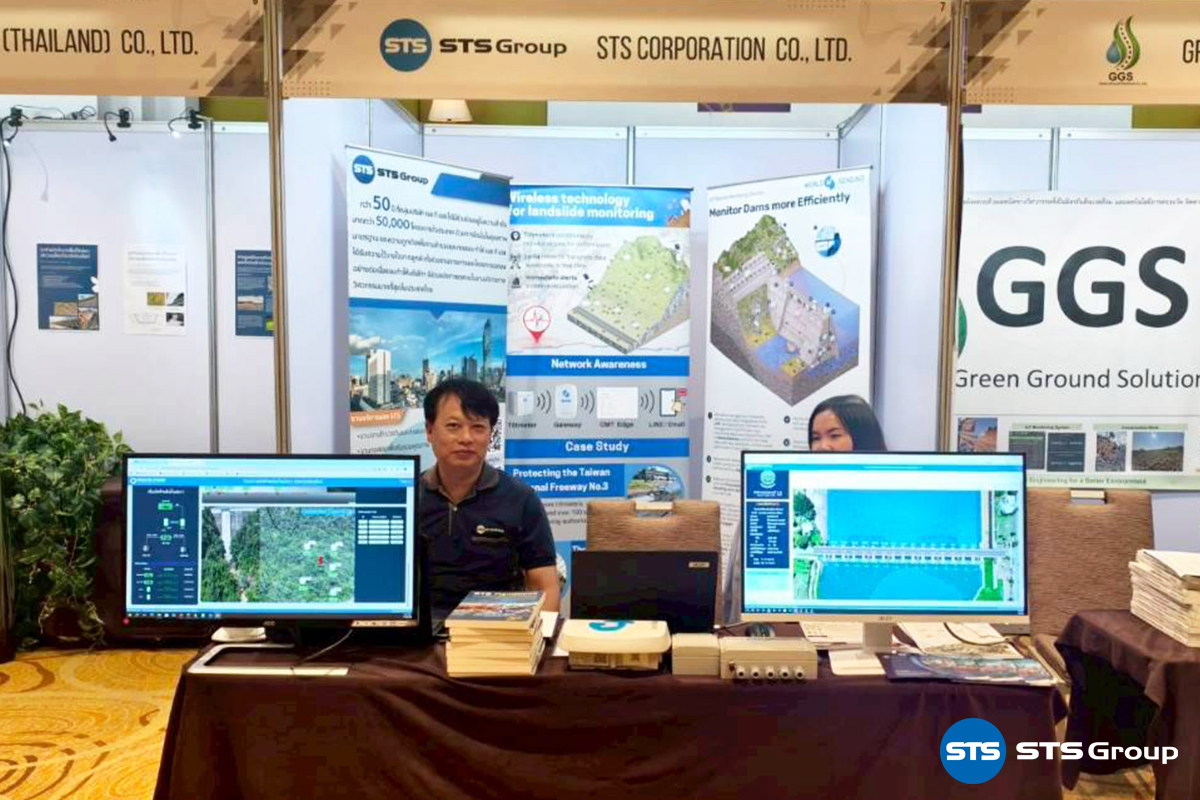
STS Group ร่วมออกบูธงานสัมมนาสหวิทยาการเพื่อการจัดการภัยดินถล่ม ครั้งที่ 1
STS Group ร่วมออกบูธงานสัมมนาสหวิทยาการเพื่อการจัดการภัยดินถล่ม ครั้งที่ 1 (MULTI DISCIPLINARY FOR LANDSLIDE MITIGATION)
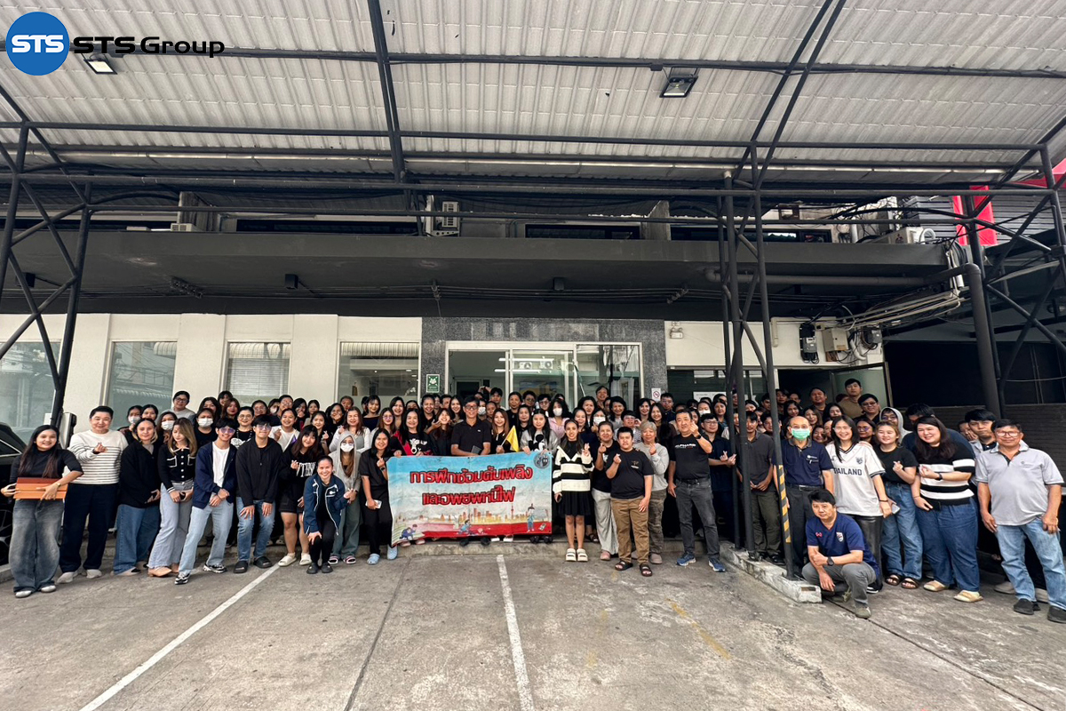
STS Group ได้จัดอบรมดับเพลิงขั้นต้น และซ้อมอพยพหนีไฟ ประจำปี 2568
STS Group ได้จัดอบรมดับเพลิงขั้นต้น และซ้อมอพยพหนีไฟ ประจำปี 2568
กลุ่มบริษัท เอส ที เอส มอบเงินช่วยเหลือผู้ประสบอุทกภัยในพื้นที่ภาคใต้ ผ่านสภากาชาดไทย
กลุ่มบริษัท เอส ที เอส มอบเงินช่วยเหลือผู้ประสบอุทกภัยในพื้นที่ภาคใต้ ผ่านสภากาชาดไทย
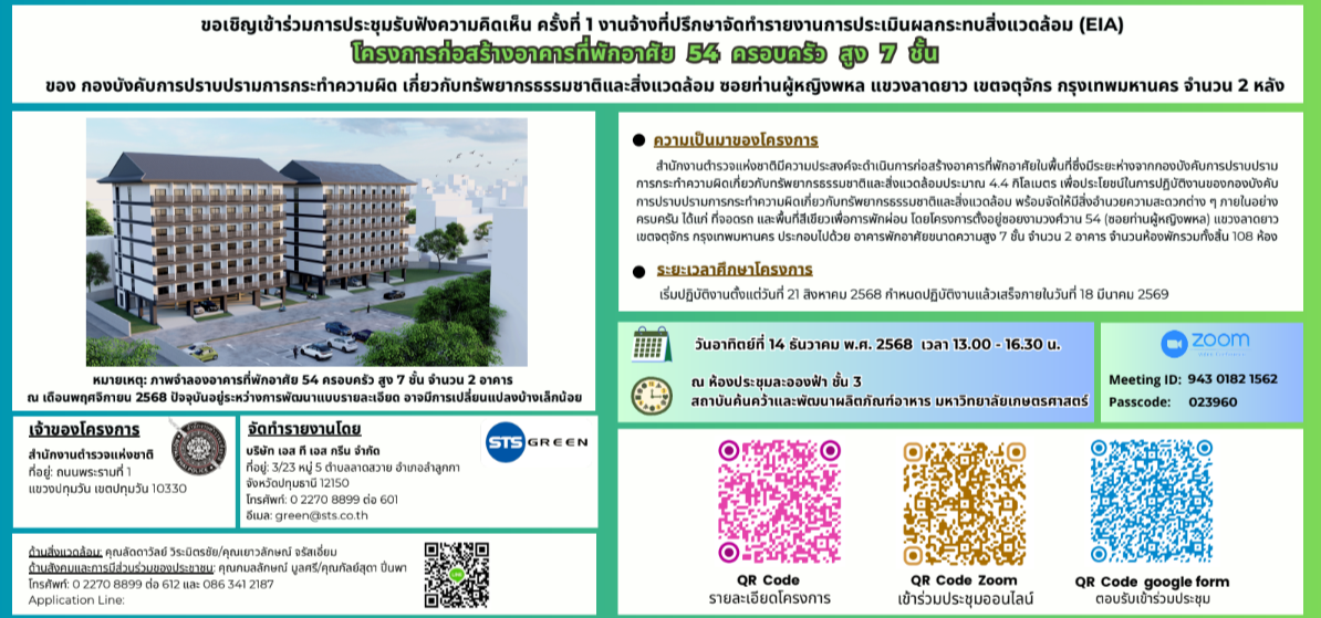
ขอเชิญเข้าร่วมประชุมรับฟังความคิดเห็น ครั้งที่ 1 งานจ้างที่ปรึกษาจัดทำรายงานการประเมินผลกระทบสิ่งแวดล้อม (EIA)
ขอเชิญเข้าร่วมประชุมรับฟังความคิดเห็นครั้งที่ 1 งานจ้างที่ปรึกษาจัดทำรายงานการประเมินผลกระทบสิ่งแวดล้อม EIA โครงการก่อสร้างอาคารที่พักอาศัย 54 ครอบครัว สูง7 ชั้น ในวันอาทิตย์ที่ 14 ธันวาคม 2568
Parallel Seismic Test
Parallel Seismic Test
Drill Hole Monitoring Test
Drill Hole Monitoring Test
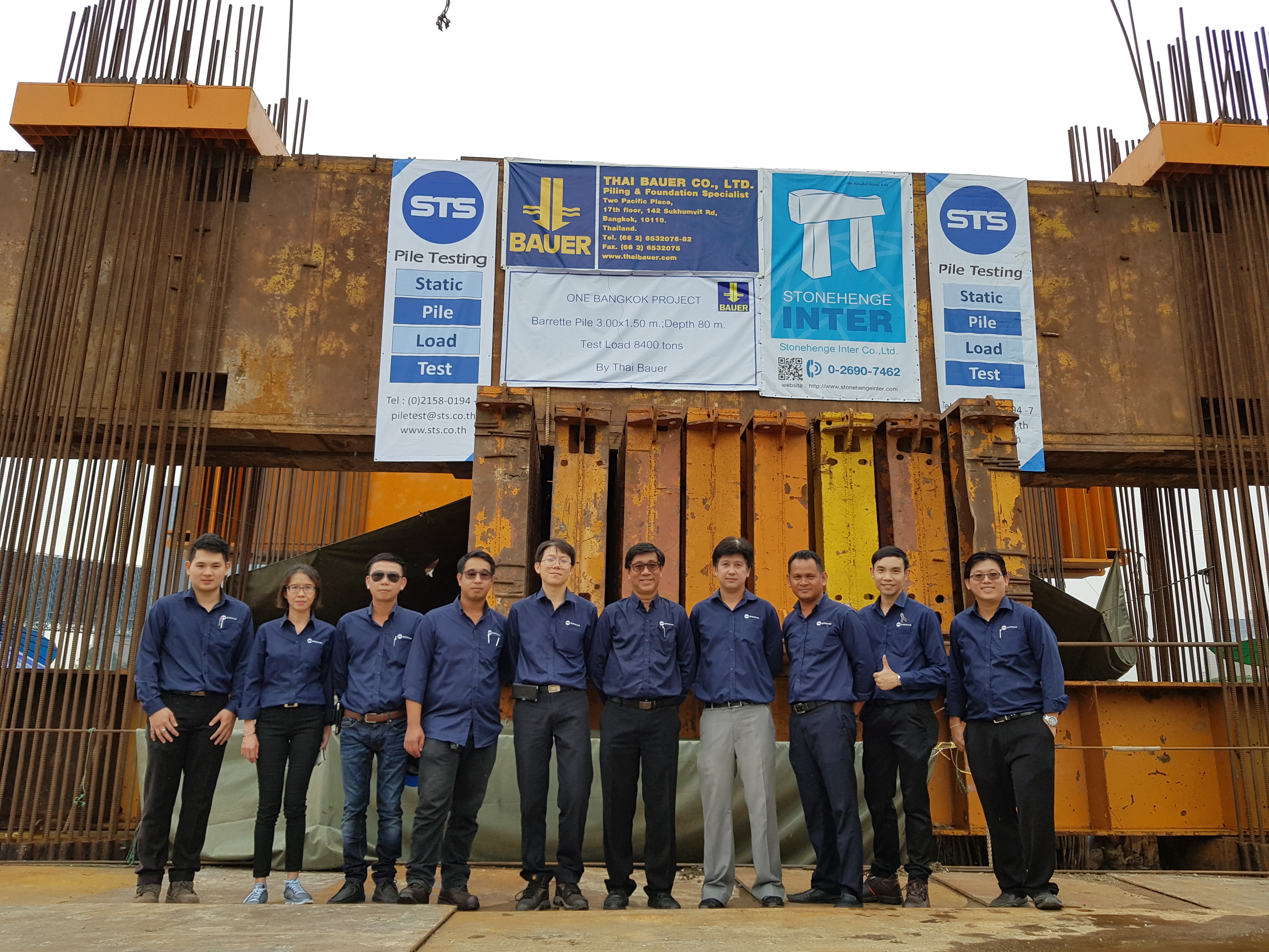
Pile Capacity Test
Pile Capacity Test
Pile Integrity Test
Pile Integrity Test
STS Group จัดกิจกรรมโครงการกังหันร่วมใจ คืนชีวิตใหม่ให้คลองสี่
STS Group จัดกิจกรรมโครงการกังหันร่วมใจ คืนชีวิตใหม่ให้คลองสี่
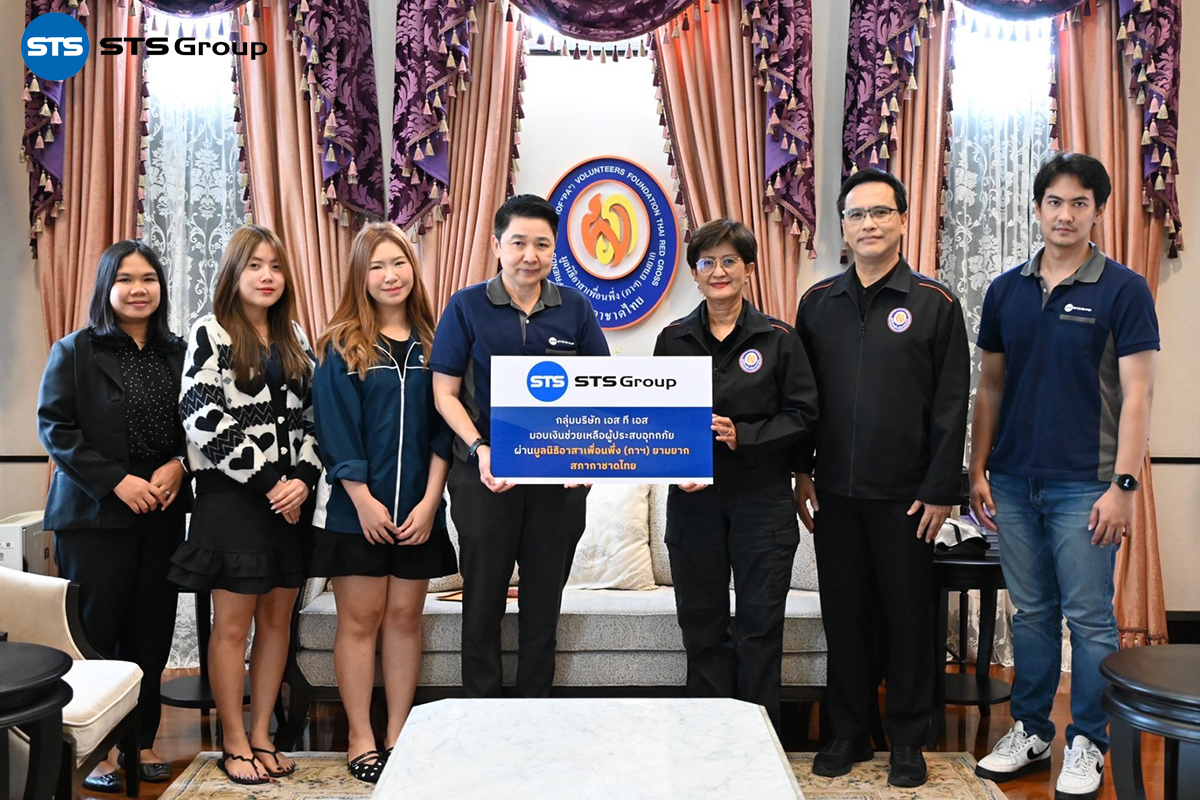
กลุ่มบริษัท เอส ที เอส มอบเงินช่วยเหลือผู้ประสบอุทกภัย ผ่านมูลนิธิอาสาเพื่อนพึ่ง (ภาฯ) ยามยาก สภากาชาดไทย
กลุ่มบริษัท เอส ที เอส มอบเงินช่วยเหลือผู้ประสบอุทกภัย ผ่านมูลนิธิอาสาเพื่อนพึ่ง (ภาฯ) ยามยาก สภากาชาดไทย
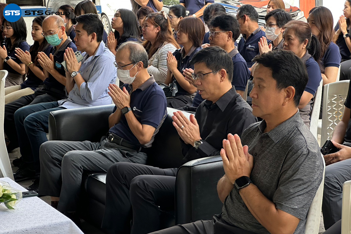
กิจกรรมทำบุญสำนักงานใหญ่ บริษัท เอส ที เอส ประจำปี 2568
กิจกรรมทำบุญสำนักงานใหญ่ บริษัท เอส ที เอส ประจำปี 2568
STS Group ร่วมงานบรรยายหัวข้อ ‘การเจาะสำรวจดินเพื่อคุณภาพงานวิศวกรรม จำเป็นหรือไม่ ทำอย่างไรให้ถูกต้อง และใช้ผลอย่างไร’
STS Group ร่วมงานบรรยายหัวข้อ ‘การเจาะสำรวจดินเพื่อคุณภาพงานวิศวกรรม จำเป็นหรือไม่ ทำอย่างไรให้ถูกต้อง และใช้ผลอย่างไร’
1
2
3
4
5
6
7
8
9
→
>>
This website uses cookies to enhance your experience and providing the best service from us. Please confirm the acceptance. You can learn more about our use of cookies from our “Cookies Policy”
Learn More
Accept
×
แชทผ่าน LINE
สแกน QR Code เพื่อแชทกับเรา
×
โทรศัพท์
โทรหาเราเบอร์นี้
02 270 8899